

Project RiverGuard.
Bamboo riverbank buffers for climate resilience in Madagascar. Environmental impact scaled with carbon finance.
Cyclone-driven floods are stripping Madagascar's riverbanks.
Along Madagascar's east coast, deforested hillsides shed rainfall in violent pulses. Rivers swell, tear at their banks, swallow the rice paddies alongside them, and carry the island's fertility into the Mozambique Channel in plumes visible from space.
The people who lose the most are riparian smallholders — farmers whose fields sit metres from a river they no longer trust. Every cyclone season deepens rural poverty and pushes households further into charcoal and slash-and-burn agriculture, which strips the uplands and worsens the cycle.
Project RiverGuard restores the banks that are failing, with dense ribbons of non-invasive clumping bamboo. Stabilised soil, supplied households with construction poles, fuel and income within three to five years, and relieved pressure on natural forest. Carbon finance pays for the environmental outcome — the bamboo carbon removal and the avoided deforestation. Adaptation benefits (protecting communities from cyclone-driven flood damage) sit alongside as a non-market outcome under Article 6.8, funded through separate instruments such as the Adaptation Benefits Mechanism.
Every river reach, scored in the open.
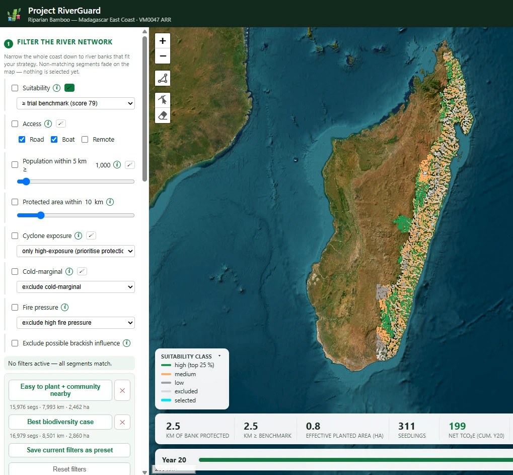
The RiverGuard siting platform scores every ~500 m river segment along Madagascar's east coast against a field-validated suitability benchmark. Fourteen satellite and global datasets, calibrated against the reaches where SaniTap's own trial plantings verifiably thrive.
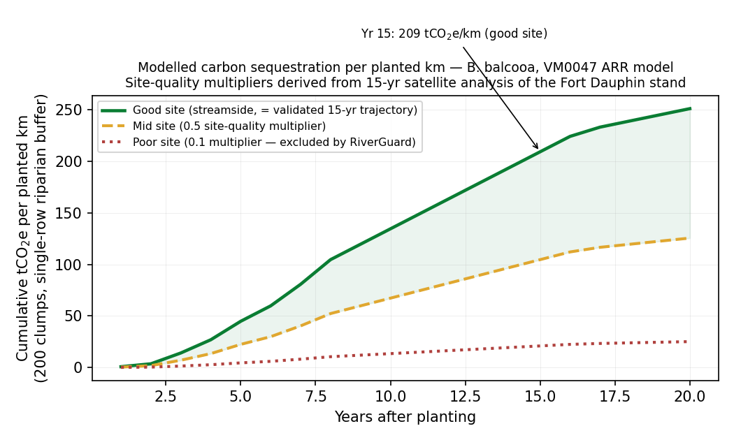
The platform recommends where to optimise planting, and just as importantly, where not to. It has been calibrated against an absolute field benchmark — the plantation growth signal from 15 years of satellite imagery over SaniTap's own Bambusa balcooa stand near Fort Dauphin. Every reach the platform flags as high-suitability meets the same growth-signal standard as the reference site.
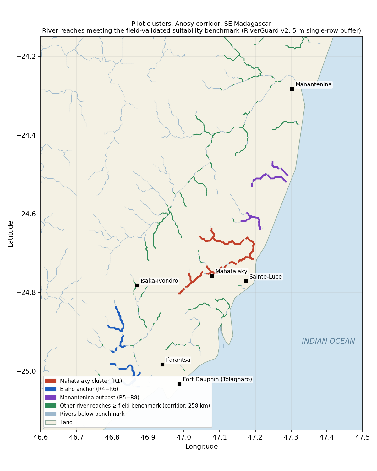
The corridor result matters. 258 km of validated high-suitability riverbank in the Anosy corridor alone; a modelled 16,418 km meeting the same standard across the east coast. The whole coast has been scored: 57,000+ segments, 28,500 km of riverbank.
Fifteen years of growing evidence.
15-year plantation
SaniTap's own Bambusa balcooa stand near Fort Dauphin, established in 2010 with INBAR support. 18.13 ha of measured canopy today, anchored to satellite imagery back to planting. This is the growth curve every RiverGuard suitability score is calibrated against.
2026 three-river planting
3,000 seedlings, three species (Bambusa balcooa, Bambusa tulda, Bambusa multiplex — all clumping, all non-invasive), three rivers. The platform predicted two successes and one failure. It was right on all three.
Corridor at scale
258 km of field-validated high-suitability riverbank in Anosy alone; a modelled 16,418 km across the east coast meeting the same benchmark. Every km scored is a km ready for restoration when funding lands.
The RiverGuard evidence base.
Delivery designed for the people who live on the riverbanks.
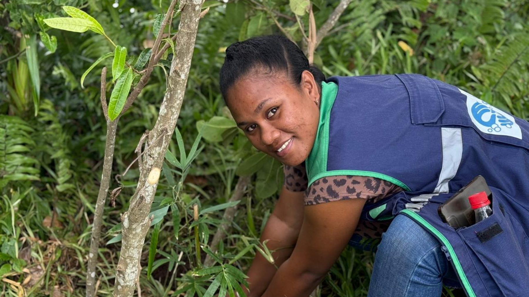
Planting is paid work, organised through village assemblies with documented consent. Women-led micro-nurseries grow the seedlings under paid contracts. Women's teams plant the buffers and maintain them.
Community delivery is led by SaniTap's Malagasy partner NGO MadAvance, which employs over 80 local staff across field operations, project management, community engagement, monitoring and maintenance. The technical and operational capacity for RiverGuard is built in Madagascar, salaried in Madagascar, and stays in Madagascar.
Restoration that pays for itself is restoration that survives.
A restored bamboo bank is not a monument. It is a productive asset. Selective harvesting of mature culms from year seven onwards leaves the clump, its rhizome mat and the standing carbon intact. Harvested bamboo feeds the local construction market (poles, panels, furniture) and briquette production for clean cooking — a market SaniTap itself anchors through its improved-cookstove programme.
Community ownership plus a local market for the harvest is the difference between planting that survives a decade and planting that is quietly abandoned in year four. Every RiverGuard site is designed around the loop.
Carbon trajectory, calibrated by 15 years of satellite data.
The Verra VM0047 ARR carbon model is anchored to the growth signal from the 15-year plantation. Site-quality multipliers derived from that dataset separate a validated streamside site from a marginal one — the platform excludes the marginal ones.
Locally-led delivery, internationally-grounded science.
MadAvance
SaniTap's Malagasy NGO partner. Over 80 local staff. Leads village-assembly consent, women-led micro-nurseries, planting teams, and long-term maintenance of every RiverGuard site.
SaniTap
Programme design, siting platform, carbon-and-adaptation-finance interface, and the 15-year Bambusa balcooa plantation that anchors the science.
The science and finance behind RiverGuard
Riverbanks, soil, water and carbon — the ecosystem science of riparian restoration
When a Malagasy river loses its banks, it does not just lose land. It loses the topsoil that fed those banks, the groundwater that recharged from them, the...
18 MIN READ Methodology
Suppressed demand — the baseline concept that makes safe-water carbon credits work
Suppressed demand is the accounting principle that lets a safe-water or clean-cooking carbon credit be measured against the consumption a household should have,...
14 MIN READ Climate mitigation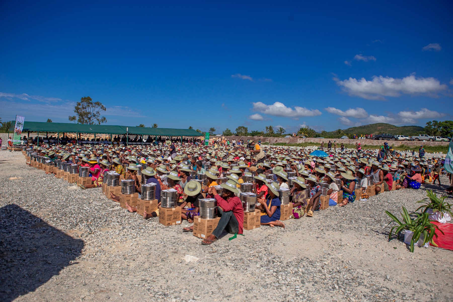
Two levers, one country — how clean cooking and safe water avoid emissions in Madagascar
SaniTap's mitigation portfolio combines clean cooking and safe drinking water in a single country. Both cut biomass combustion; both are third-party verified...
10 MIN READ Policy
Article 6.8 and adaptation — non-market finance, and how the ABM can fund tropical-storm-resistant safe drinking water
Adaptation does not generate a tradable tonne of CO₂. That single fact is why adaptation finance has lagged mitigation finance by an order of magnitude for two...
15 MIN READFund, partner, or offtake on RiverGuard.
Talk to SaniTap about supporting the RiverGuard programme, taking the pilot to scale, or joining the science and delivery consortium.